


|
THE ISLAND OF SAI
Among the largest islands in the Sudanese part of the river (12 by 5.5 km), it is dominated by Jebel Adu. Almost totally arid, it is nevertheless possible for the inhabitants to cultivate its banks. Near the Pharaonic settlement and the excavation house the beauty of the scenery is striking.
The first excavations on the island began in 1954 under the direction of Jean Vercoutter. The following year the Sudanese authorities asked the Egyptologist to accept the position of 'Commissioner for Archaeology'. He is the first Frenchman to take on the direction of the Sudanese Antiquities at Khartoum. At Sai, the excavations continued until 1956 and then from 1969 to 1981. They started again in 1993 and continued to 2005, run by his successor, Francis Geus, until his premature death.
At the beginning of the Holocene (c. 10 000 years before our era), the river deposes sediments over the whole island, followed by settlement in the upper Palaeolithic. However, the settlement becomes truly significant from the beginning of the III millennium before our era.
In the north, the area of Saisab has: - Pre-Kerma granaries and two Kerma cemeteries, - A Pharaonic camp dating to the Middle Kingdom and an Egyptian town of the New Kingdom as well as a vast necropolis - A cathedral, still awaiting excavation - An Ottoman fort.
At the centre, in the area of Morka: - a settlement of the middle Palaeolithic - a large necropolis of the Kerma period - a large settlement area including Neolithic sectors and one Kerma sector - two X-Group cemeteries.
To the south, the area of Arodin includes: - a Kerma Ancien cemetery and one of the X-Group - Christian dwellings |
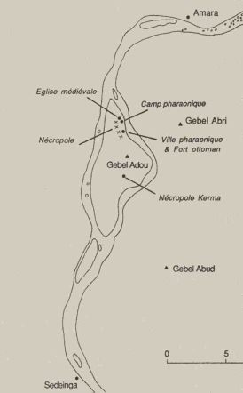    Map of the main archaeological sites of Sai island / Situation des principaux sites archéologiques de l'ile de Saï
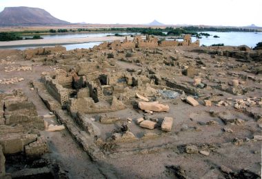
Setting-up of the egyptian town at the New Empire period, on the Sai Island / Implantation de la ville égyptienne au Nouvel Empire dans l'ile de Saï
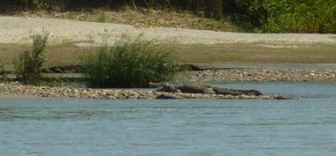
crocodiles on the eastern side of the Nile, near Saï / sur la rive orientale du Nil, face à l'ïle de Saï |
|
The most attractive areas for a visitor are:
a) At the centre of the island, at the large Kerma period cemetery. In the 1970s Brigitte Gratien identified there the great historical phases of this culture, thanks to a comparative study of the funerary material found in the tumuli. Some tumuli, whose diameter reaches as much as 40m stand out among thousands of graves. Their characteristic is a ring of black stones that delimits the monument, which is covered by white pebbles (the same is true at the cemetery of Kerma itself). According to Francis Geus, some of the graves must have belonged to the princes of Shaat, of which the Egyptian inscriptions speak. It is possible that at a certain period the king of Kerma entrusted them with the defence of the northern approaches to the kingdom.
b) To the north east, the ruins of the Pharaonic town are astonishing. Over an area of 140 x 280m, it is protected by its circuit walls of 4.3m thick. It dominates the Nile, which made surveillance of the river navigation possible. In the XVI Century the Ottomans make use of the same location, to build on the southern part of the settlement an imposing fortress of mud brick. In the southern sector Jean Vercoutter unearthed Egyptian buildings laid out according to an orthogonal plan. In the northern sector, along the Nile, he exposed an impressive series of foundation deposits that belonged to a temple of the XVIII Dynasty.
c) To the north, before taking the boat to regain the mainland, the visitor should pause by an unexcavated church, probably cruciform in plan, that scholars have identified as a cathedral. Currently, only four columns of grey granite emerge from an area covered in fragments of fired brick and pottery sherds. Francis Geus has pointed out that during the Medieval period Sai was the seat of a bishopric. Saï is a remarkable site. Jean Vercoutter had foreseen this, and Francis Geus confirmed it. See on the slide show, photos of Francis Geus – The Pharaonic Town.
|
|